Three Use Cases for Wayfinding Signage in Multimodal Transportation Systems
Unlike automobile-oriented systems that prioritize vehicular traffic over other forms of transportation, multimodal transportation systems incorporate walking, cycling, and public transit equally.
These different modes of transportation require different approaches to wayfinding signage. At NSP, we apply a three-tiered hierarchy to wayfinding in multimodal transportation systems.
- The Directional Tier focuses on vehicular orientation. Route functionality is as important as design and content. At times, DOT requirements will influence design but not the route continuity.
- The Informative Tier engages pedestrians and cyclists once they’ve transitioned out of the vehicular state. The features are designed to transmit information based on the end user’s needs.
- The Interactive Tier can often be location- and environment-specific and should deliver information through static, digital, and smartphone-enabled media with the purpose of elevating an experience.
Keep reading to learn how we applied this methodology to multimodal transportation systems in three cities.
Multimodal Wayfinding in Congested Downtowns.
The City of Georgetown in Texas sought to boost event engagement among residents and visitors and economic development for local businesses.
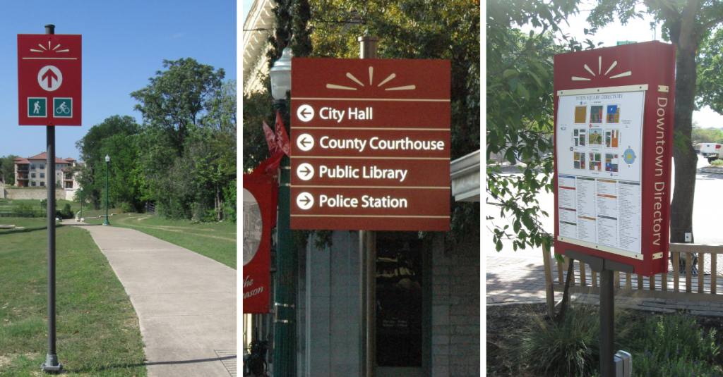
The city’s new wayfinding and placemaking system serves vehicular, pedestrian, and cyclist traffic plus public transit around its historic downtown. The system includes directional signage, walking and biking path markers, map kiosks, identifiers for points of interest, and wifi access points.
Since the wayfinding system was implemented, Georgetown has hosted more events with greater attendance and greater business participation.

Multimodal Wayfinding in Active Communities.
As an active lifestyle destination, the Town of Paradise Valley in Arizona sought to redevelop their automobile-oriented traffic corridors into multimodal routes that accounted for walking, cycling, and even golf carts!
In addition to typical directional signage, each corridor includes three shade structures to accommodate bikers and walkers. The structures enhance the aesthetics of the route while providing educational opportunities for visitors to learn about the area’s nature and history.
Although it’s a town of under 15,000 residents, Paradise Valley’s investment in small city wayfinding paid off. Its traffic corridors now serve as a staging platform for pedestrians and cyclists to explore the many activities available within the town’s borders.
Multimodal Wayfinding in Campuses and Complexes.
When developing its sprawling state-of-the-art Civic Center, the City of Surprise in Arizona selected NSP to design, plan, fabricate and install the wayfinding and placemaking signage throughout the complex.
The facility’s street network required directional street signs to guide vehicular traffic to parking and pedestrian signage linking parking lots and bus stops to destinations such as city hall, court rooms, and recreation facilities.
Meanwhile, the adjoining parks and recreation complex required branded wayfinding and environmental graphics to assist pedestrians, bikers, and more to navigate the myriad athletic fields and courts in the complex.
Is Multimodal Transportation a Priority for Your City?
Multimodal wayfinding helps your residents and visitors engage with your city by foot, on bikes, and via public transit. Let’s discuss your wayfinding project!